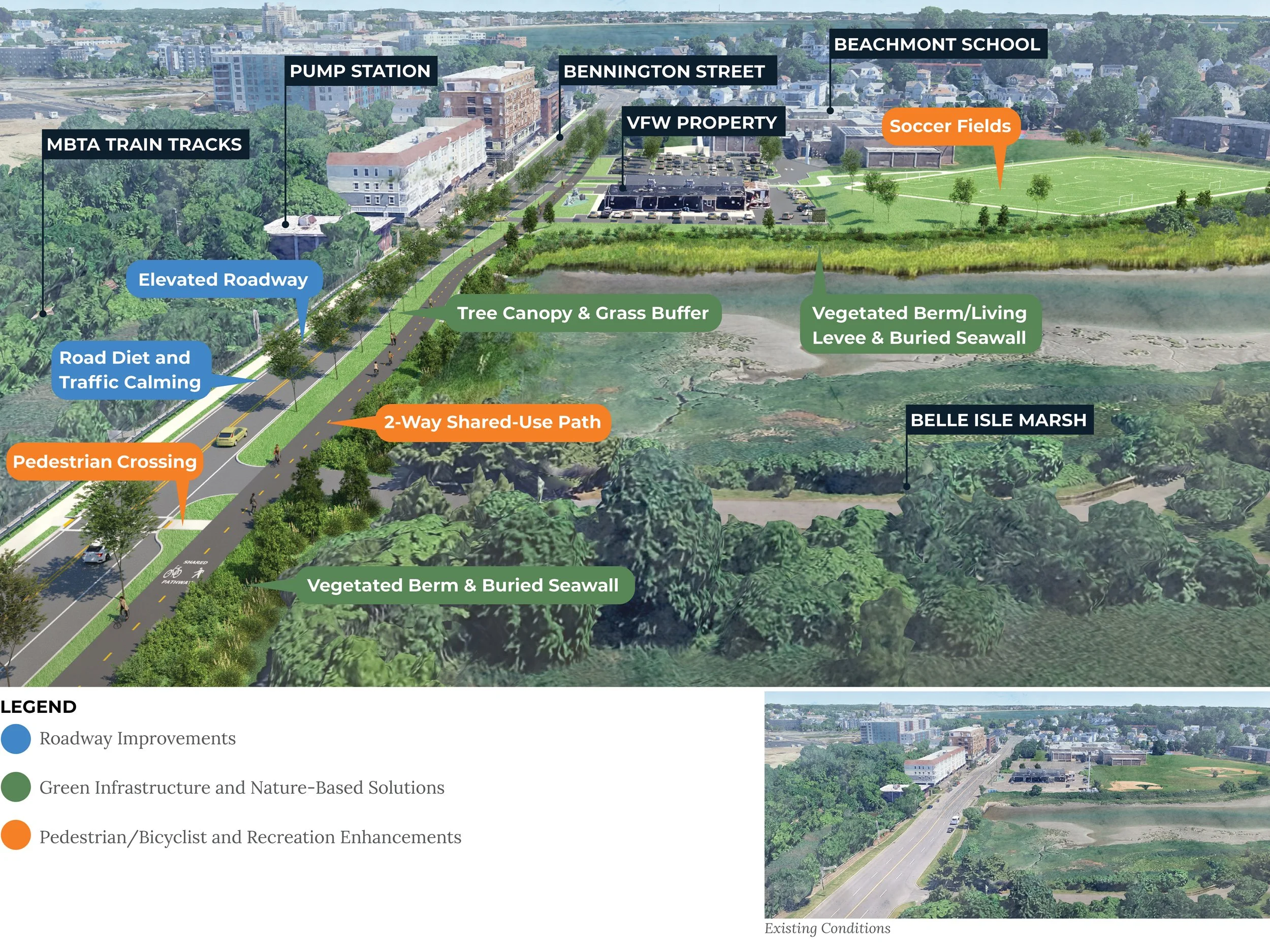
Bennington Street and Fredericks Park
Bennington Street and Fredericks Park are being redesigned as part of regional efforts to improve coastal resilience in the communities around Belle Isle Marsh.
Sea level rise and more intense coastal storms are causing Bennington Street, a designated evacuation route and major arterial road, to flood more frequently and severely. Beachmont Elementary School, which serves a student body that is two-thirds non-white, is vulnerable to school delays and cancellation because of coastal flooding.
The City of Boston and City of Revere are collaborating to elevate the road, add shared use paths, and plant trees to provide long-term transportation resilience, as well as raise the Fredericks Park and build a berm along the marsh with native salt-tolerant plants to protect Beachmont School.
The project team completed field work, a design report, engineering plans, and cost estimates to move the project closer to being shovel-ready. Portions of the design have been passed on to MassDOT for further development.